Development of the Dâmbu River, Ploiești
Authors’ Comment
General concept – Reactivating the Dâmbu river corridor
The project represents our proposal for the 2026 civic imagination competition “Places in Becoming” – redevelopment of the Dâmbu riverfront, Ploiești.
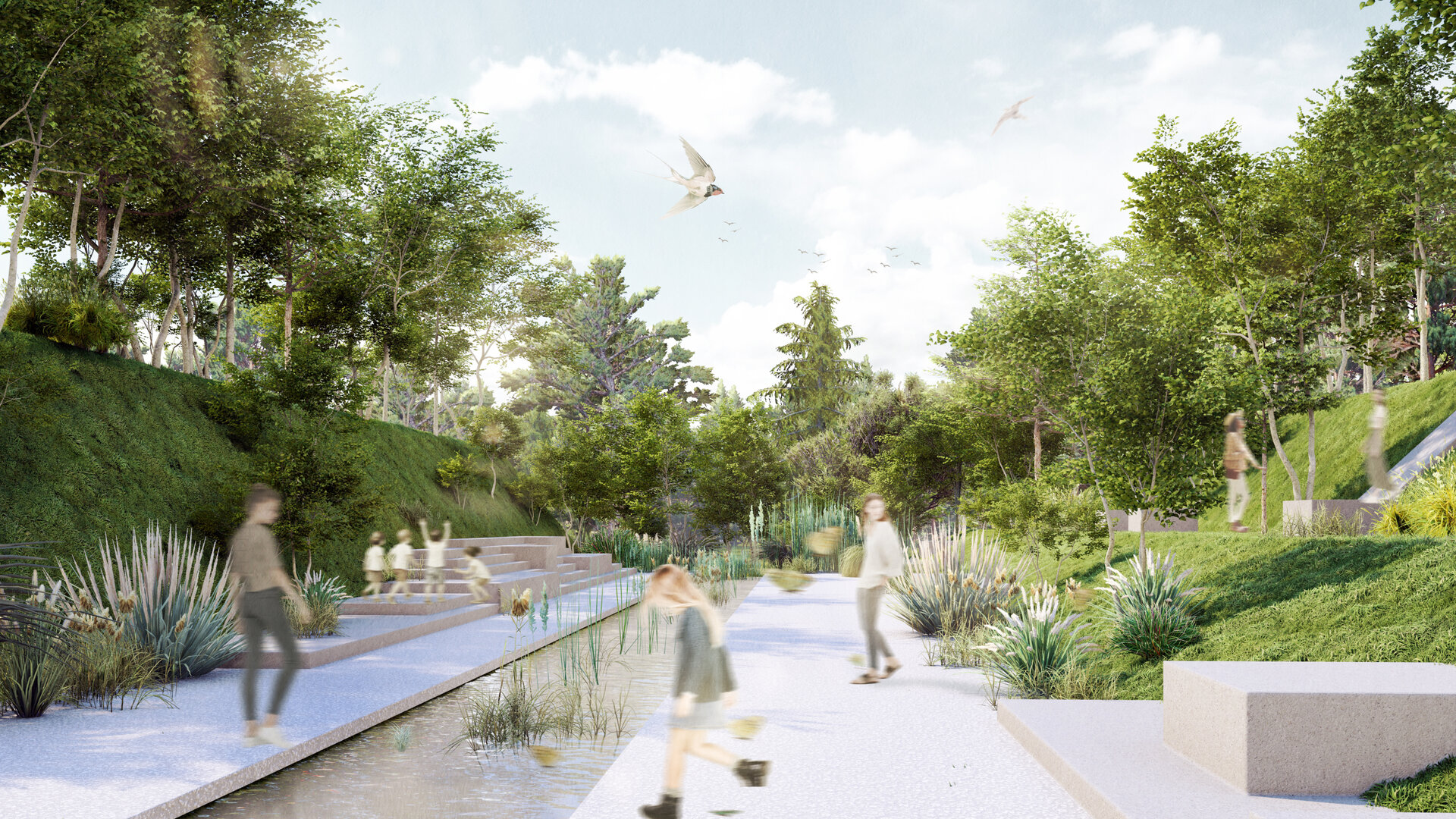
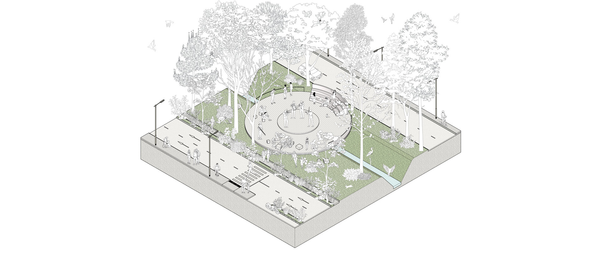
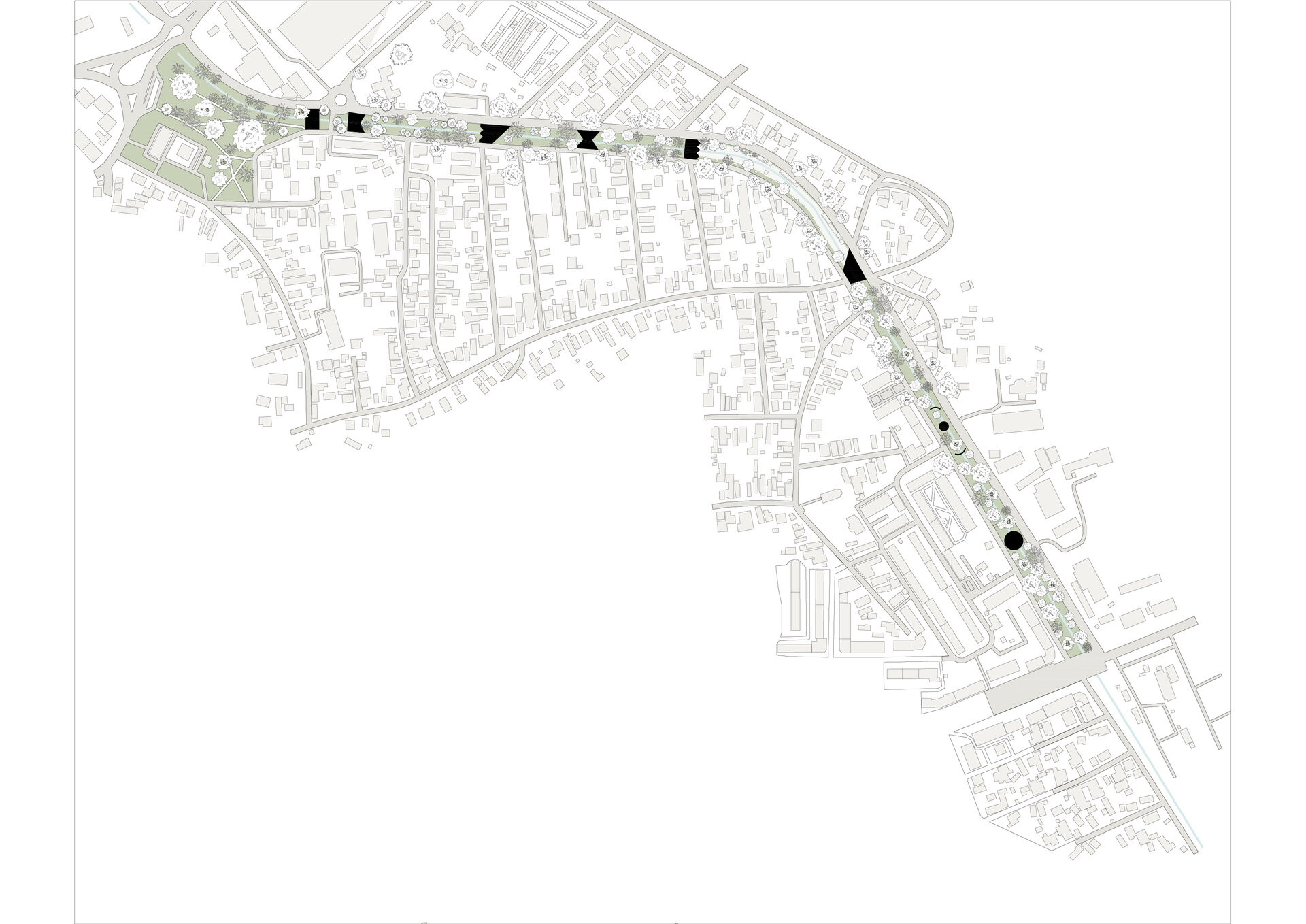
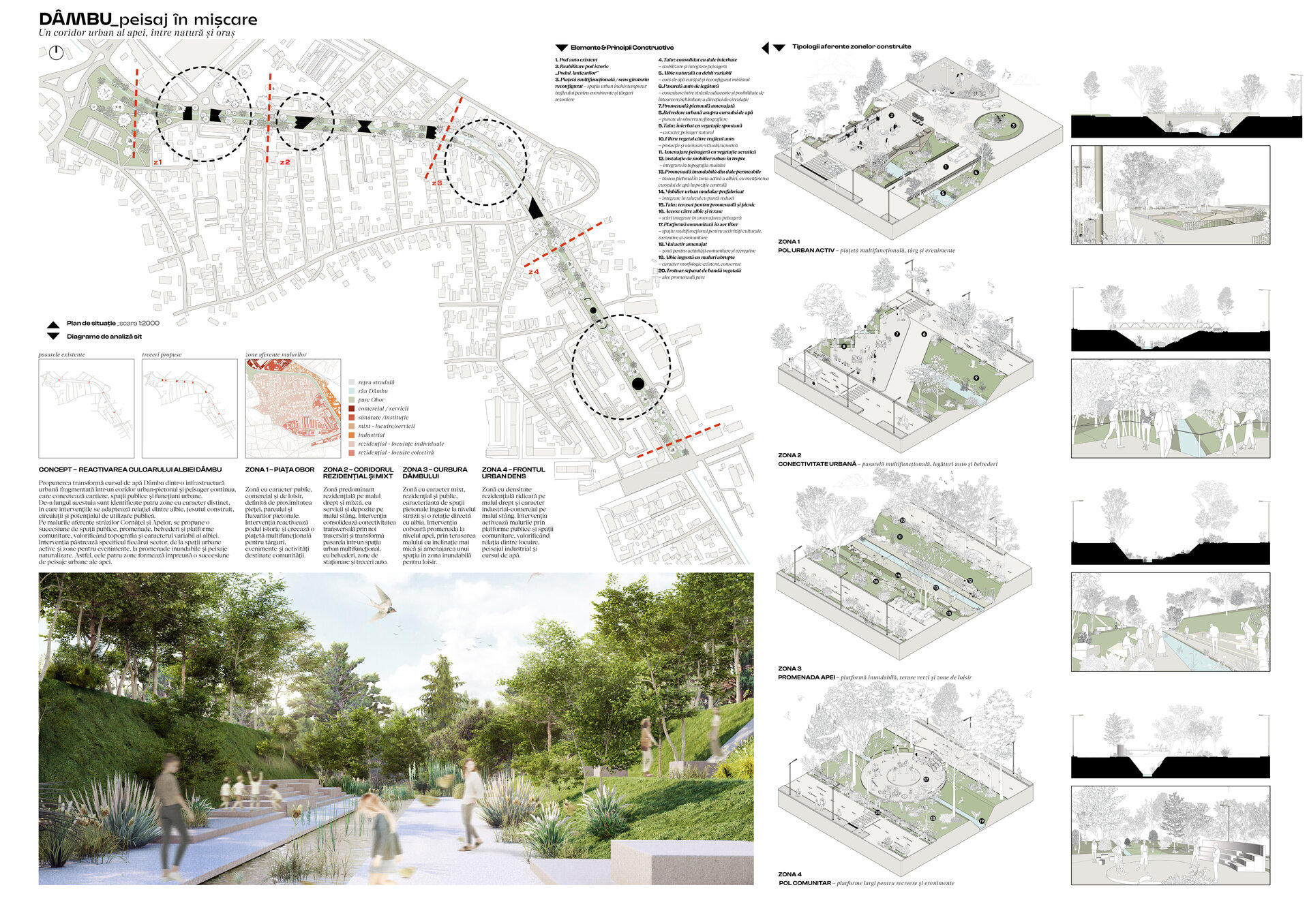
The proposal transforms the Dâmbu river from a fragmented, predominantly residual urban infrastructure into a continuous pedestrian and landscape corridor connecting neighbourhoods, public spaces, and diverse urban functions. Rather than standardizing the riverbed, the intervention builds on the identity of each sector through a sequence of waterside landscapes: a plaza and event space, passage and viewpoint, floodable promenade and naturalized landscape, and community platforms and recreational spaces.
Four distinct zones are identified along the river, each responding to the relationship between water, built fabric, circulation, topography, and public-use potential. Along Cornățel Street on the right bank and Apelor Street on the left, the route integrates promenades, viewpoints, and community platforms while preserving the distinct character and topography of both banks.
Zone 1 – Obor square
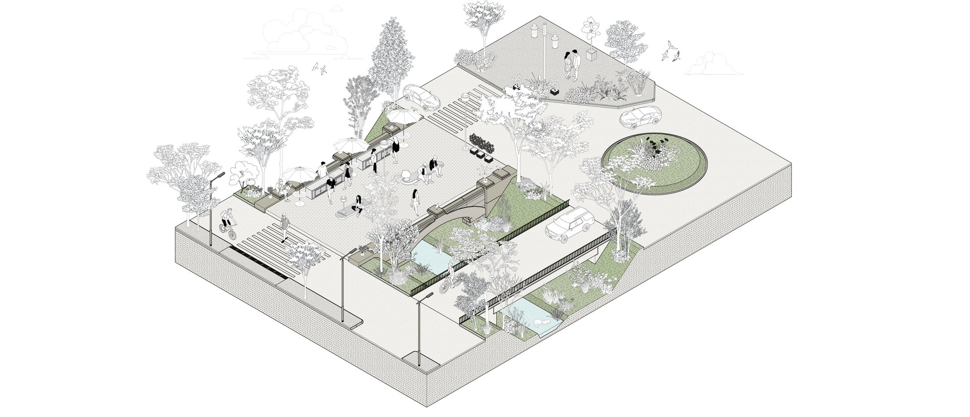
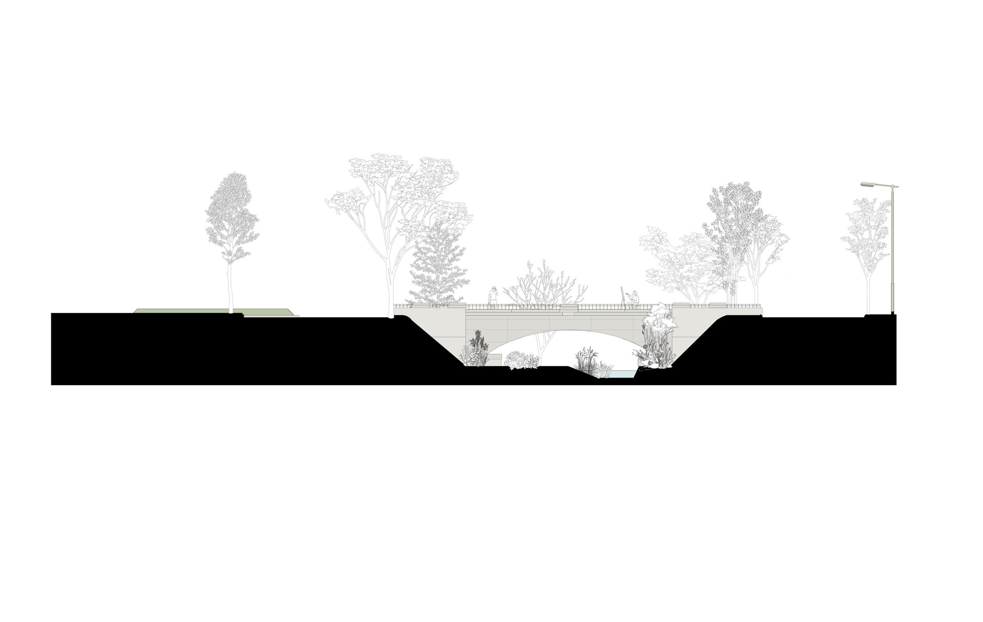
The route’s main public hub, connected to the market, commerce, services, and adjacent park, is reactivated by transforming the disused historic “Antique Dealers’ Bridge” into an urban landmark and a setting for reorganizing the existing flea market. The roundabout becomes a multifunctional plaza, retaining everyday traffic while allowing temporary closure for seasonal markets, cultural and community events, and a Christmas market. The plaza connects the Obor market area with the park and river.
Zone 2 – Residential & mixed corridor
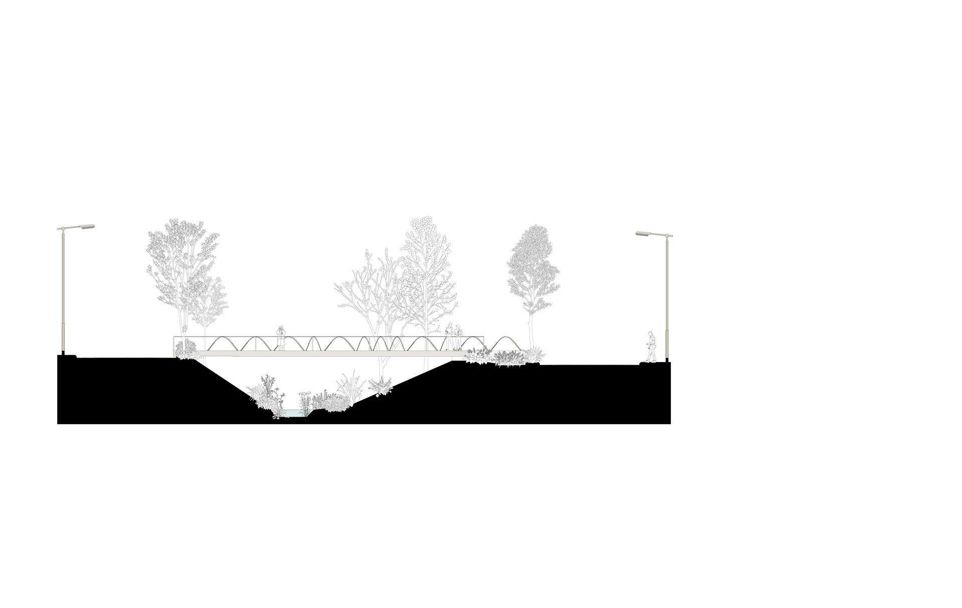
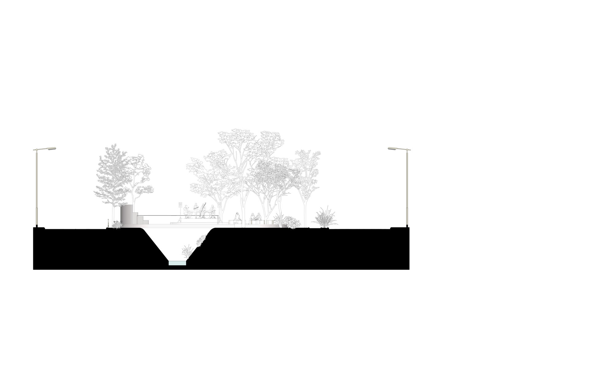
Between the individual housing along Cornățel Street and the residential, service, and storage functions along Apelor Street, the intervention improves cross-river permeability through new pedestrian and vehicular connections. The existing footbridge is reinterpreted as a multifunctional passage incorporating seating, small terraces, temporary installations, and events. Viewing points bring users closer to the water and its ecosystem without compromising the river’s natural functioning.
Zone 3 – Dâmbu curve
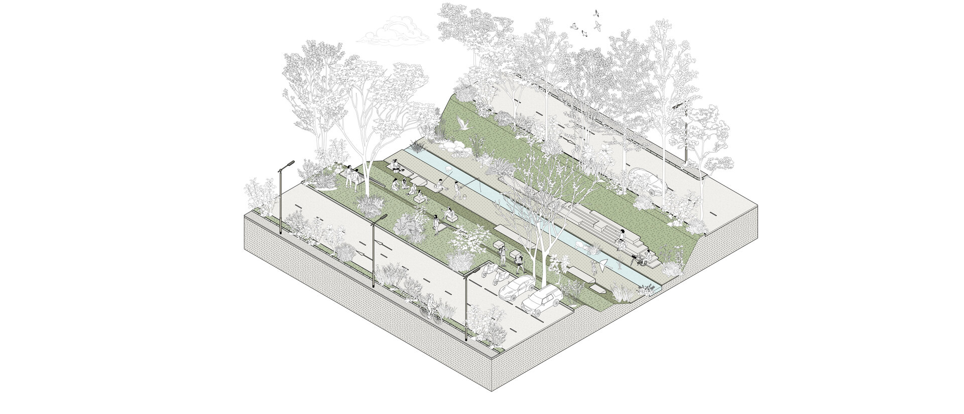
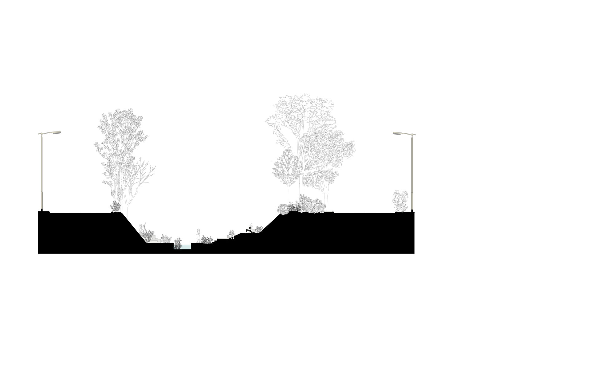
Where street-level pedestrian space is limited, the route moves into the river valley as a controlled floodable promenade. In normal conditions it operates as a leisure space; during higher flows, it allows temporary occupation by water. Steps integrated into the slope and localized terracing of the right bank create access and green seating areas for picnics, reading, rest, and small events. Furniture, lighting, and planting are adapted to moisture and flooding, while the river remains the central element.
Zone 4 – Dense urban front
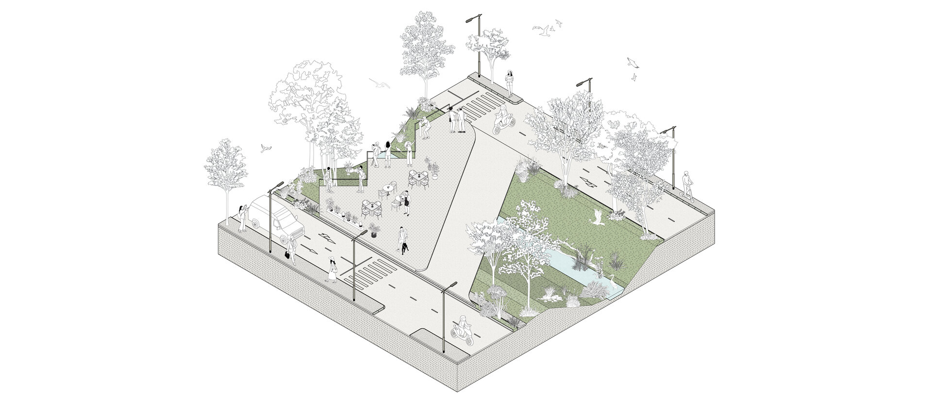
Between collective housing on the right bank and industrial, commercial, and storage areas on the left, the Dâmbu becomes a connecting element and shared public space. Local community platforms provide places for recreation, neighbourhood gatherings, temporary exhibitions, community activities, and cultural events. New stopping points, promenades, and views toward the water and vegetation transform the river into an accessible public space with long-term urban regeneration potential.
Public Architecture

- Open Landscape
- Ground Zero Pavilion - Concrete as Witness
- Prapori. Church and Centre for Studies and Research – CDS Paris
- The Land of the Deer, Masterplan
- The Architecture of Sound Bell Tower of Vatopedi Monastery, Mount Athos: Relocation of the Existing Bells and Installation of 12 New Bells
- Urban Intervention / NOOR - The Calligraphic Light of Form
- Development of the Dâmbu River, Ploiești
- Urban Toilets / Fields of Safety - Beyond Sanitation
- Benești Kindergarten
- Tetris Park
- Dracula Land
- Nest
- New Museum of Architecture and Design Helsinki, Finland
- Monarch
- The Museum of History and the Future Turku, Finland
- Palliative Care Hospital. Architecture as Support for Dignity and Care
- EduHub - children’s educational center in Urlați, Prahova
- Day center for children. Architecture for Support and Inclusion
- ADR Nord-Vest headquarters
- Mihai Bravu Convention Center and Hotel
- Christo and Jeanne-Claude Centre for Contemporary Art, Gabrovo, Bulgaria
- Center for Therapies and Social Services
- Moldova HiTech Park
- Beclean Masterplan
- Mizil Secondary School No. 1 – Architecture for Education and Community
- Intervals


