Via Golden Quadrilateral. C Area. The Flow of Memory in Buciuman Cultural Landscape
Authors’ Comment
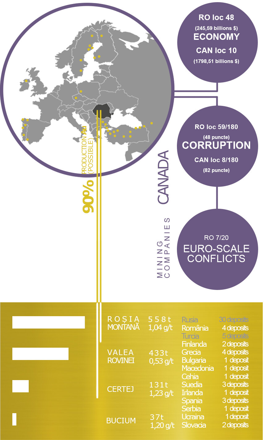
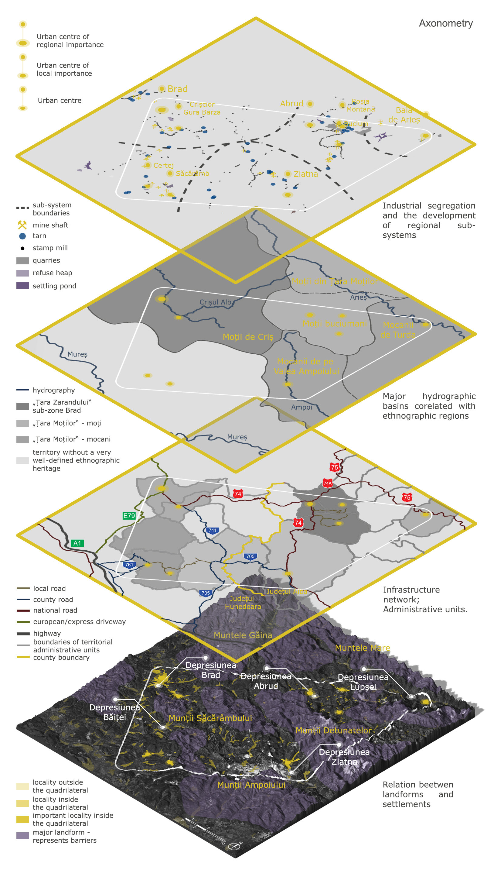
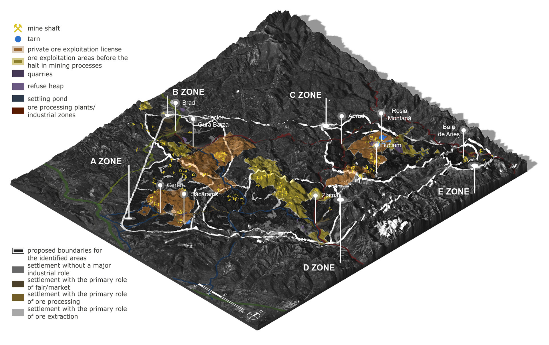
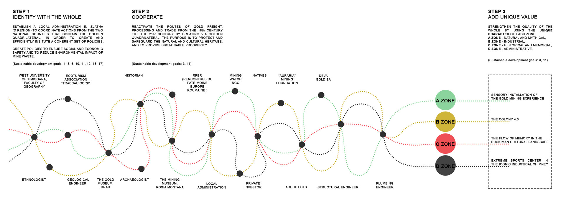
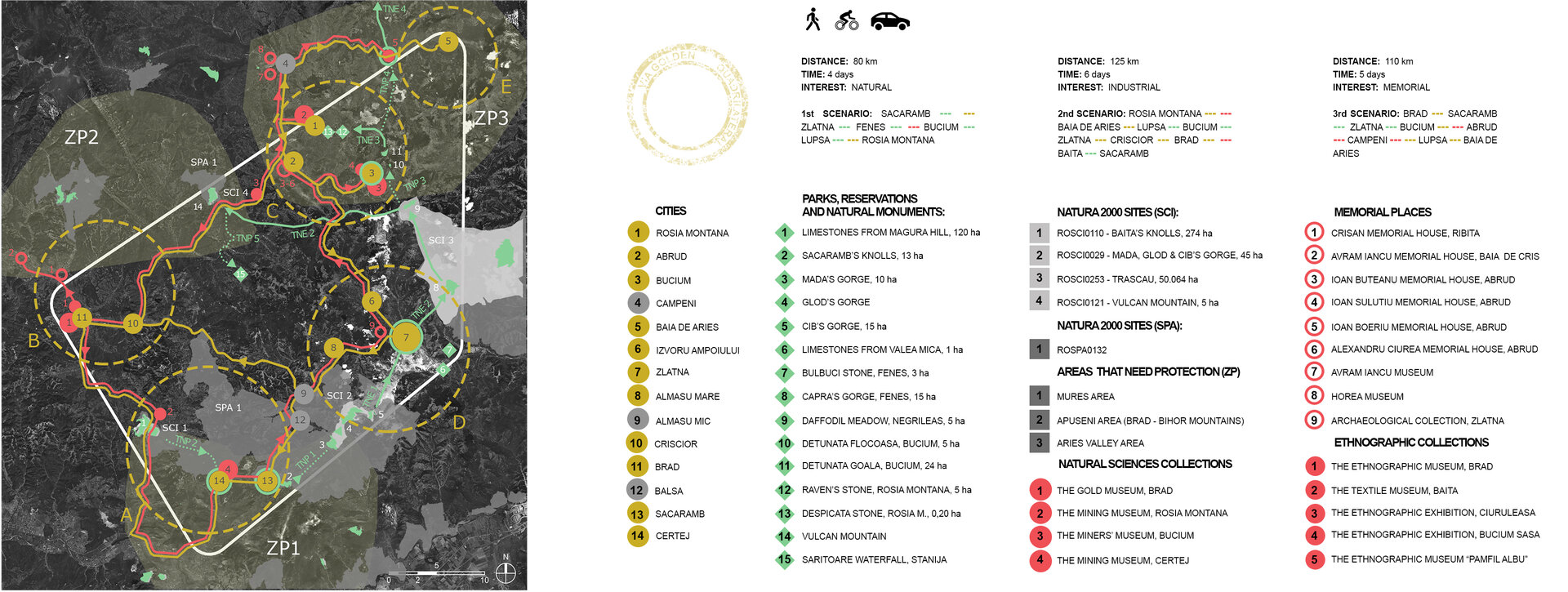
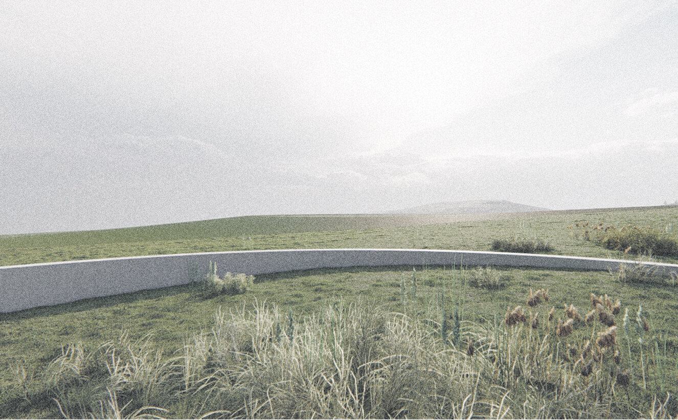
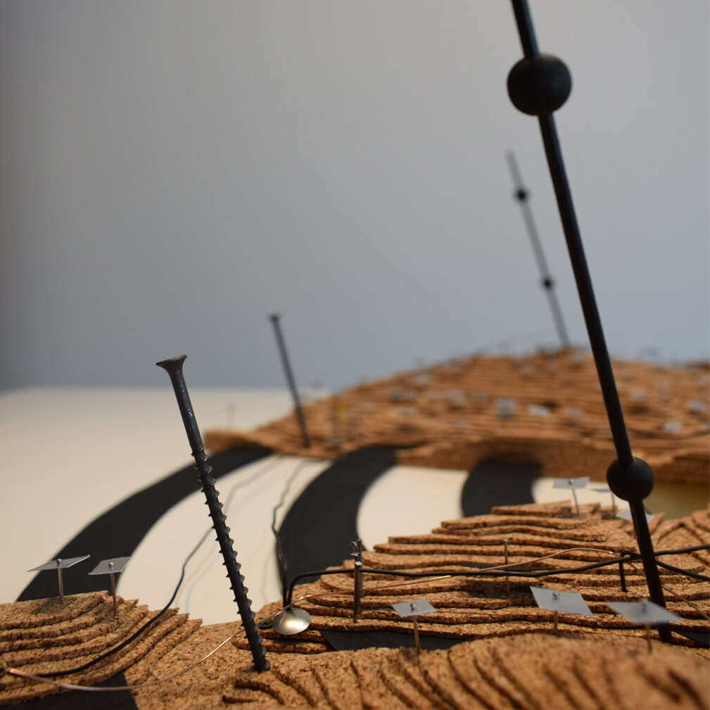
This thesis represents a detailed segment of the Via Golden Quadrilateral, which is part of a strategy to revitalize the entire Gold Quadrilateral structured on three pillars - natural, cultural and industrial. Starting from an understanding of the cultural landscape as a complex mechanism, a series of micro-interventions in Area C (Bucium) is proposed to allow the traveler to research the Buciuman gold mining landscape.
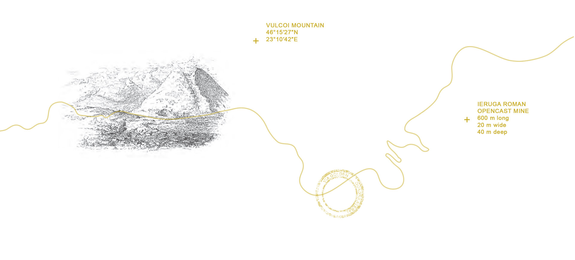
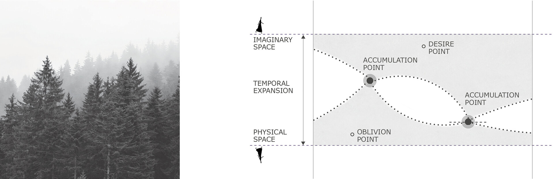
This mechanism was born in the depth of Vulcoi Mountain, along with the formation of gold veins. However, its functionality was not possible without the desire for possession of the precious metal by man. GOLD becomes a character in itself in the history of humanity, a link in time between generations and a mediator of geographical boundaries. The unwritten link between man and gold set in motion flows of people, goods and knowledge between points of the territory. They are not grouped into functional areas, but are scattered and integrated into the landscape. The routes that connect them are not predefined, but offer freedom of configuration. Thus, the mechanism took the form of a horizontal network of interdependent points. But this spatial horizontality is subordinated to the verticality of time. The network of points receives a new dimension - memorial. Placed in a space of time, the points correspond to two projections - a projection in the physical space and one in the mental space of the adventurer.
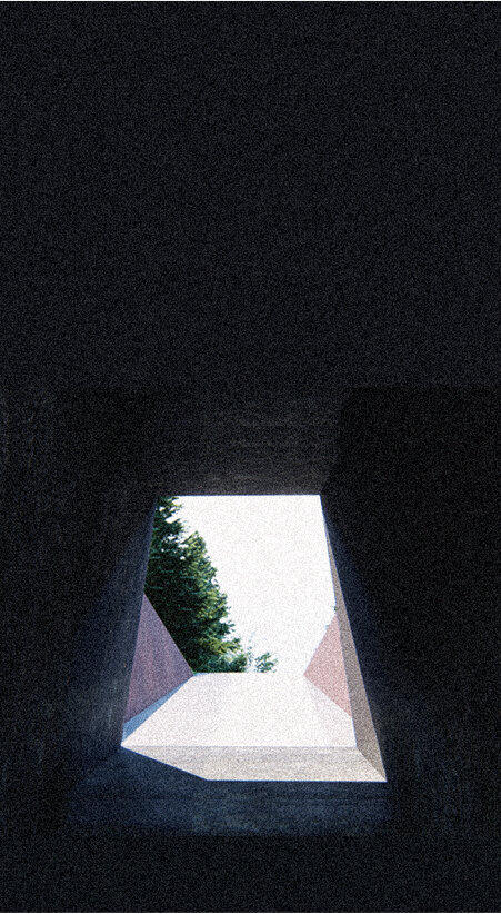
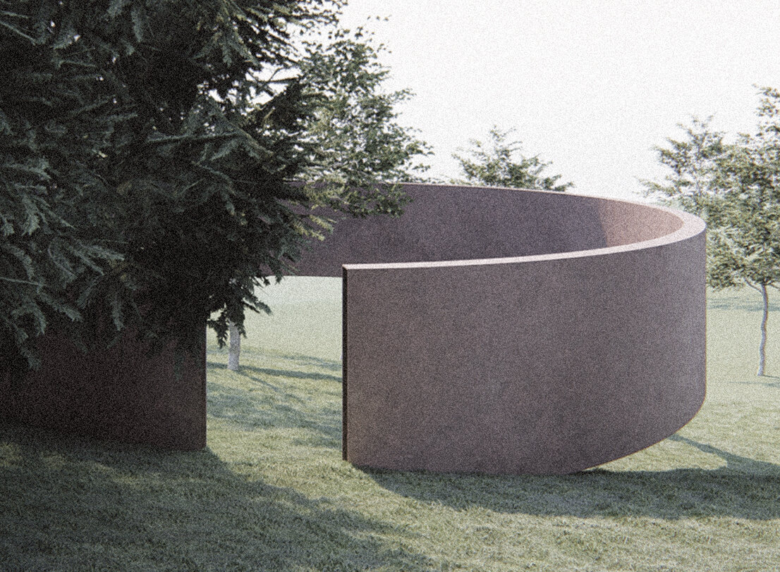
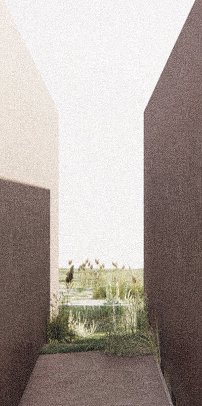
When one of these projections disappears, the accumulation point dissolves. The cultural landscape is thus a result, a summation of each person's interactions with the landscape and his perception of it. Micro-interventions are made at such points and aim at a (re) approach of the traveler to the landscape.
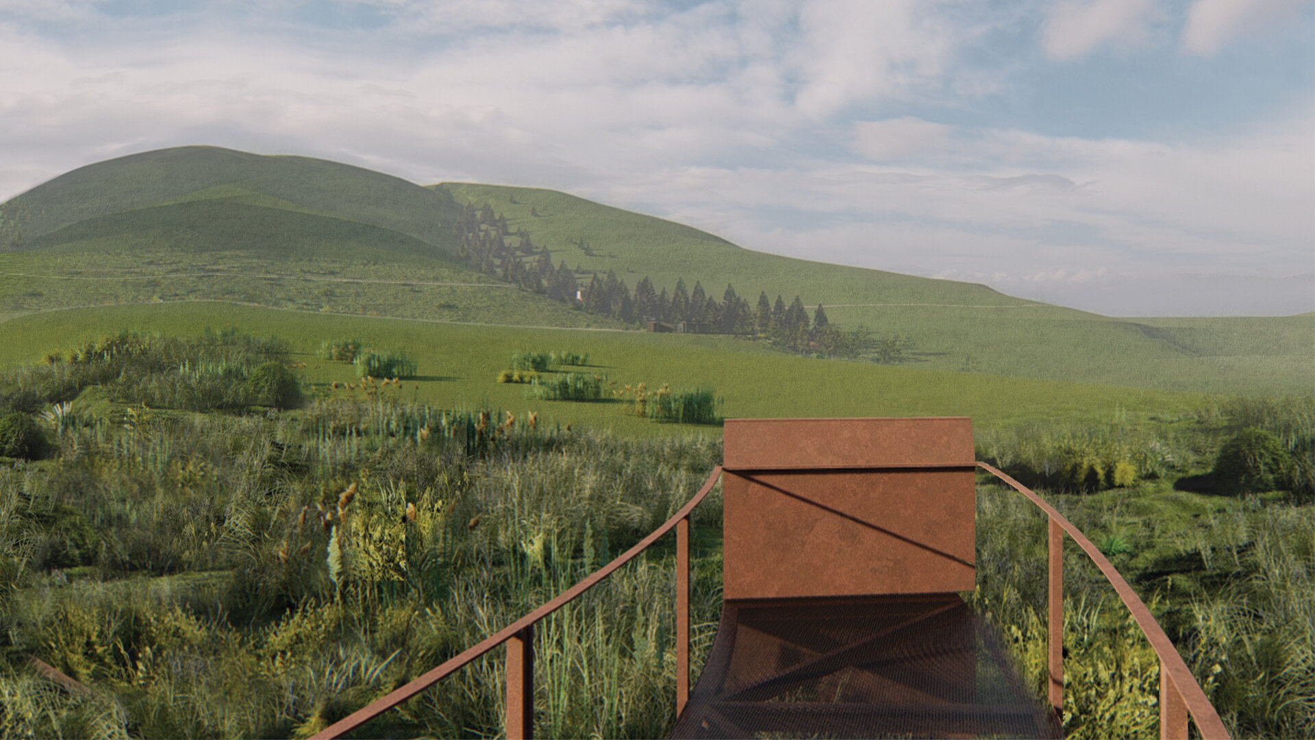
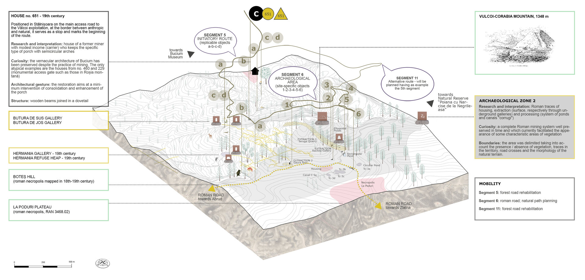
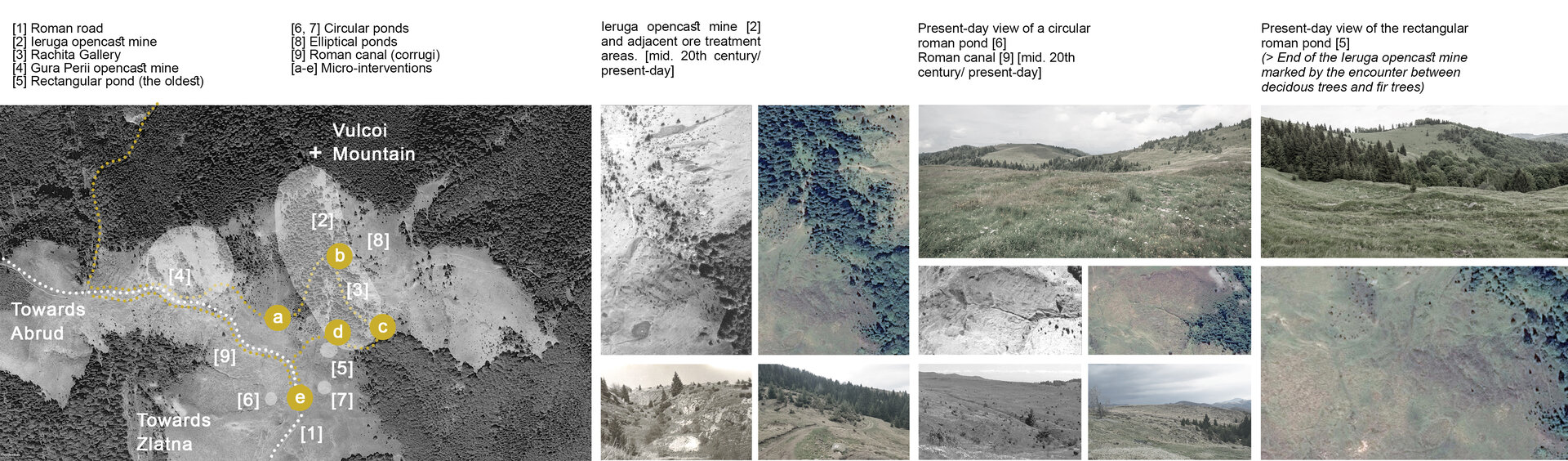
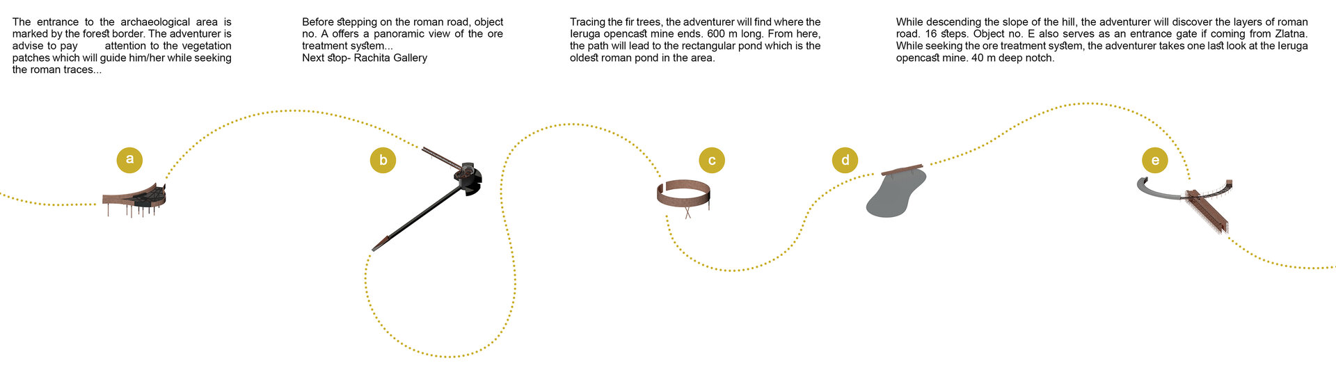
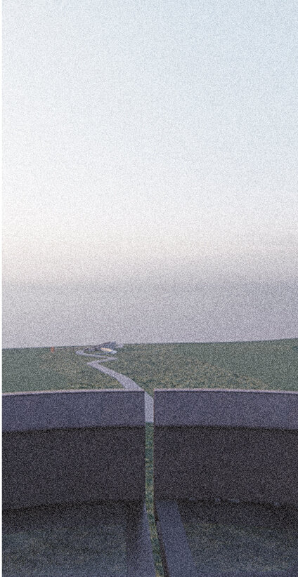
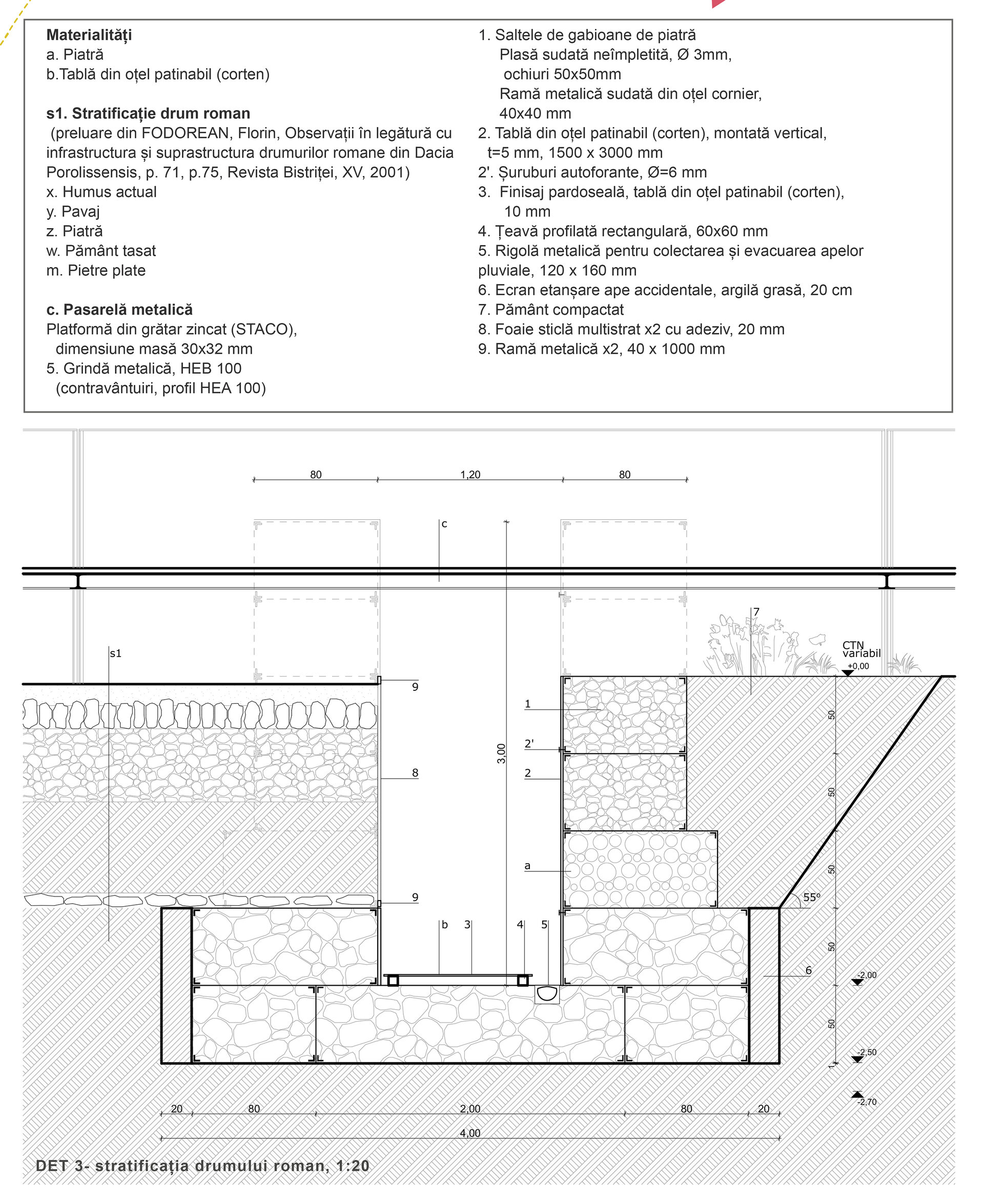
The project focuses on points dating back to the Roman period. An area of 100 ha with a complete mining network, currently subject to archaeological research. Opencast mines, ponds and canals for ore processing, traces of houses, necropolises and the Roman road that connects them. The most prominent is the Ieruga opencast mine (600 m long, 20 m wide and 40 m deep), a surface exploitation along the vein that splits the mountain and which offers an identity and a landmark at the macro level. But all this can go unnoticed. The southern part of the slope, subject to micro-interventions, has been mapped since the 18th century as a deforested area. The cessation of the activity allowed a layer of vegetation to appear in the former exploitation and processing areas. Photographs from mid. 20th century show the beginning of this process, and today the trench is covered by a coniferous forest. Vegetation, thus, becomes the research tool of the landscape, a mediator between the human scale of the traveler and that of the landscape explored.
Architecture Diplomas
- Beyond the ruin. The conversion of the former tobacco warehouse of Isaccea
- Balneo-physio-therapeutic recovery center. Extension of Sylva Villa, Băile Govora
- Shelter with dignity
- The Bucharest City Loop
- Fort 13 Jilava. Political repression museum and research center
- Activating industrial premises – Student Center
- Hotel at Capidava
- Palaeontology research and visitor center – Hațeg District
- Memorial for the jews of Bukovina
- Agri-Park on the Nikolics domain
- Johann Michael Haydn Music Institute
- Creative Industries Factory in London
- Urban Cistern, Amman
- Refunctionalization and extension of the former sanatorium for border guards, Herculane Baths. Centre for body-mind treatment and accomodation
- “Țara Hațegului” International UNESCO Geopark. Fragments. Territorial diversity path
- The Roundhouse: built heritage academy
- Equestrian center of recovery and leisure on the former racecourse of “Nicolae Romanescu” park
- House of Movement. Ballet school and performing arts center in Bucharest
- Lacustrine Resort. The Danube River at Corabia
- Ludoteca
- Extension of the Baths ensamble, Băile Govora
- Drama Memorial
- New Public Architecture as Infill in Historical Context, Bucharest
- ECORIUM Local ecosystem research center
- Artist in Residence – Nae Petrescu Houses – Plantelor Street No. 56-58
- Extention of Public School of Arts and Crafts
- The Castle with Unicorns. Reactivation through school, arts and crafts of the Kornis Castle Ensemble in Mănăstirea Village
- House of games
- A New City Center – Conversion of the Pozzi Ceramic Factory, Laveno, Italy
- Urban Revitalization – Calea Moșilor
- Archaeological cultural center in the Constanta Peninsula
- Lapidarium. Extension of “Vasile Pârvan” Institute of Archaeology, Bucharest
- Pavilion complex within the “Măgura” sculpture camp, Buzău
- Recovery, revitalisation and insertion. Creative hub
- Integration through co-presence – Câmpulung Cultural Center
- C.U.B. Urban revitalization through social inclusion and cultural diversity
- Spatial Connections and Functional Conversion of Customs Warehouse, Bucharest
- ARTnEST – Performing Arts Center on Calea Victoriei
- Trauma and continuity – National Jewish museum, Victory Square, Bucharest
- Technological transformation hub
- The Enchanted Gardens of Ada Kaleh
- The revitalization of the Filipescu Park, Cultural Park Filipescu
- Terry Winery, Dragasani
- Mixed-function tower building (offices-hotel)
- Elca Market Square, Craiova
- The regeneration of Textila Factory
- Via Golden Quadrilateral. C Area. The Flow of Memory in Buciuman Cultural Landscape
